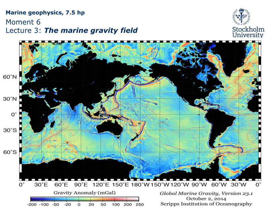
Moment 6
Lecture 1: The marine gravity field
Reading:
Chapter 6, pages 131–161 in Marine Geophysics by E.J.W. Jones.
Chapter 6 in the course book assumes some basic knowledge about Earth gravity field and the physics of gravity. It begins therefore by directly presenting theories behind different ways of measuring gravity and the history behind rather than the basic physics. We will take one step back with this lecture and begin with the physical basis of Earth gravity field. This is followed by a rather specific guide to what you should learn from Chapter 6 in the course book, which may be seen as a rather heavy chapter to go through compared to the previous chapters in the book. There is no ongoing active research directly involving the marine gravity field at the Department of Geological Sciences. This implies that we do not have our own research examples that can contribute to this course. Instead some examples from published studies are shown. This course will settle with including the area of Earth Marine Gravity Field on the most introductory level.
However, this lecture will go a bit further than Chapter 6 of the book into the relevance of Earth’s gravity for the scientific field of geodesy, because the vertical reference systems used specifically in high-precision multibeam bathymetric mapping are aimed to represent Earth’s geoid. This concept will be explained. Furthermore, it is a subject that is part of ongoing research at the Department of Geological Sciences due to that we apply a substantial amount of high-resolution multibeam bathymetric mapping in our research projects.