Moment 4
Lecture 1: Principles of echo sounding methods
Reading:
Chapter 3, pages 31–60 in Marine Geophysics by E.J.W. Jones and Mapping submarine glacial landforms using acoustic methods by Jakobsson et al. provided as a PDF.
This lecture covers principles of echo sounding methods and presents some basic concepts that should be repetition from high-school physics. The lecture requires no prior knowledge on the subject of underwater acoustics.
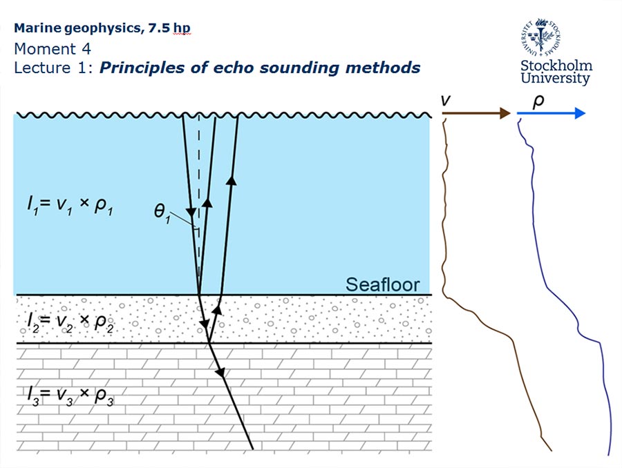
Chapter 3, pages 31–34, of the book includes a brief discussion on sound propagation in the oceans and the importance of knowing sound speed for acoustic mapping methods. The sound propagation in the ocean has basically been covered in Moment 3. However, some additional aspects on the propagation of an acoustic pulse, specifically sub-bottom through geologic materials, are included here.
Lecture 2: High resolution acoustic seafloor and subbottom mapping methods
Reading:
Chapter 3, pages 31–60 in Marine Geophysics by E.J.W. Jones and Mapping submarine glacial landforms using acoustic methods by Jakobsson et al. provided as a PDF.
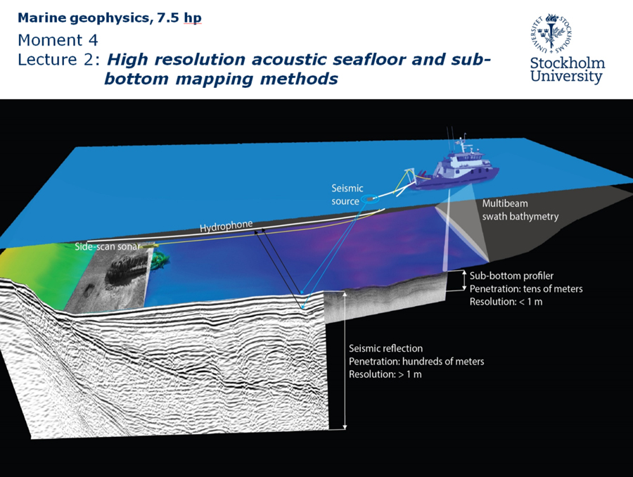
This lecture complements the book by providing additional information on acoustic high-resolution mapping methods, specifically with respect to multibeam bathymetry since that field has evolved substantially over the last decade. Section 3.5 “MULTI-BEAM SWATH SOUNDING” in Chapter 3 of the course book should therefore be viewed as providing a historical snapshot on the state of the multibeam field at the end of the 1990s. The capacity of multibeam sonars has since improved substantially. For example, it is now standard to employ several hundreds of beams rather than the numbers presented in Chapter 3. This Lecture 2 of Moment 4 and the provided PDF of Jakobsson et al. (2016) comprise the information you should learn before the exam of this course regarding multibeam bathymetric mapping.
Chapter 3 in the course book presents only a few data examples and does not include many photos of installed mapping system on vessels. For this reason there are numerous data examples included in this lecture, most acquired by the Marine Geology division at the Department of Geological Sciences, Stockholm University. In addition, several photos of installed mapping systems in vessels are included. The course book does not contain a dedicated section on errors and artifacts that may occur in acoustic mapping data. Instead, this is brought up along with that the various methods are presented. In this course we dedicate the following Lecture 3 to errors and artifacts since they unfortunately play a major role when the acquired geophysical mapping information is to be interpreted geologically.
Lecture 3: Errors and artifacts
Reading:
Chapter 3, pages 31–60 in Marine Geophysics by E.J.W. Jones and Mapping submarine glacial landforms using acoustic methods by Jakobsson et al. provided as a PDF.
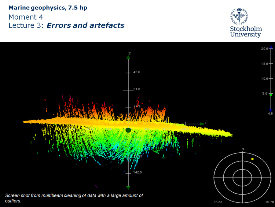
This lecture addresses errors and artefacts in acoustic mapping data along with real examples. Understanding and recognizing artefacts (American spelling: artifacts) is crucial for geological interpretation of marine geophysical mapping data. Some are possible to avoid through proper data collection and some are possible to remove during post-processing of the data. It is not possible in this lecture to present a complete catalogue of errors and artefacts since there unfortunately exist an abundance that may occur in acoustic mapping data. However, some of the most common examples are included with the intention to provide a first initial knowledge base on the subject.