Moment 5
Lecture 1: Marine seismic reflection and refraction methods
Reading:
Chapter 4, pages 60–97 and Chapter 5, pages 98–130 in Marine Geophysics by E.J.W. Jones and Mapping submarine glacial landforms using acoustic methods by Jakobsson et al. provided as a PDF.
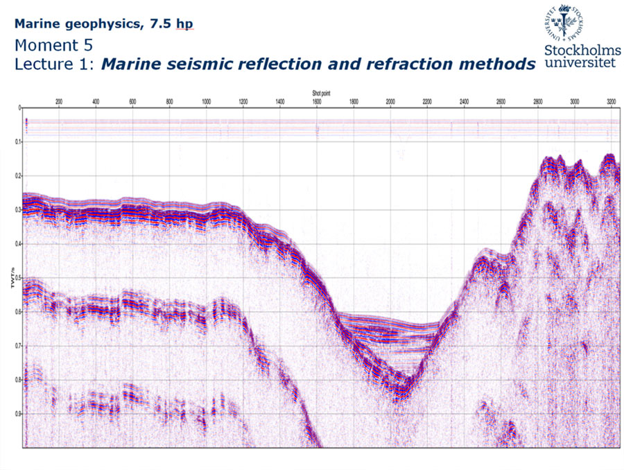
The Department of Geological Sciences has a long history of seismic reflection and refraction surveys, with an emphasis on the former. The presently active research at the department is focused on using high-resolution acoustic methods to map the seafloor morphology and uppermost accumulated sediments. Seismic reflection surveys are used for this as they complement and add to the depth penetration of a sub-bottom profiler. To map the uppermost 1 km of sediments and bedrock, which has been in our focus, relatively small seismic equipment are used and not the large setups involving arrays of seismic sources and long multi-channel streamers used in the exploration industry. The course book is quite comprehensive regarding the subject of seismic surveying, specifically in comparison to how the higher resolution methods are covered. The book begins in Chapter 4 by presenting a theoretical background.